 Foto: Elisabeth Karlsson / Länsstyrelsen
Hiking loops
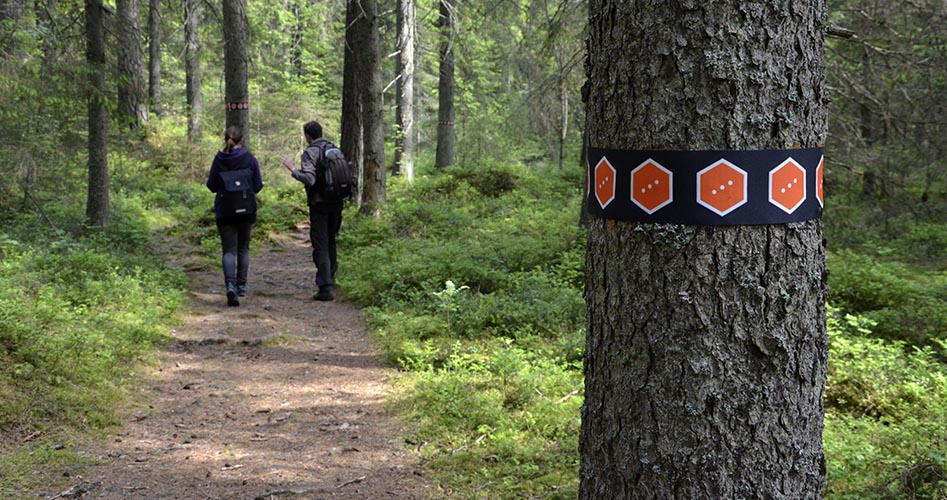
In all, there are more than 34 kilometres of marked trails that offer hikes of 0.9-9.5 kilometres. The trails will take you down into deep rift valleys and to the top of lichen-covered rocks. Please note that many of the trails are hilly and can be challenging to walk.
About the activity

1 Trail Trollkyrkerundan
4.6 km, about 3.5 hours
The trail Trollkyrkerundan (“Troll’s Church loop”) begins and ends at the Main entrance. With the help of steps and railings, you hike through Tiveden’s dramatic rift valley terrain to Stora and Lilla Trollkyrka. Along the trail there are numbered stations with information. Part of the trail goes through difficult terrain. After you have gone about one-fourth of the way, there is an opportunity to choose a shorter route that is about half as far. There is a connecting trail to the Bergslag trail to the east.

2 Trail Stenkällerundan
2.2 km, about 2 hours
The trail is short, but part of it goes through difficult terrain. The trail Stenkällerundan begins and ends at the Main entrance and is the national park’s most popular trail. It leads to the large boulders around Stenkälla, and with the help of steps, you will ascend hills that provide views all the way to Lake Vättern. Along the trail there are numbered stations with appurtenant information. From the Stenkälle loop, there is a connecting trail of about 500 m to the swimming beach at Vitsand.

3 Trail Tärnekullerundan
1.3 km, about 1 hour.
The trail is short, but part of it goes through difficult terrain. The Tärnekulle loop begins and ends at Vitsand. Take a break from the sun and swim at Lake Trehörningen’s beach. The Tärnekulle loop takes you through dark and damp spruce forest to large boulders and caves. You also will come to Tärnekulle’s dry and warm rocky ground, where pines and lichen predominate.

4 Trail Trehörningsrundan
9,5 km, about 6 hours
The longest trail in the National Park. It is nearly ten kilometres long and takes you all the way around Lake Stora Trehörningen, passing all the National Park entrances. This trail includes most of the nature types in the National Park, from old-growth forest and rocky areas to sandy shores and wetlands steeped in the fragrance of wild garlic. Long stretches lead along the lake shore with spectacular views of Lake Stora Trehörningen.

5 Trail Oxögabergsrundan
6.7 km, about 4.5 hours
A fairy long and partly demanding trail and takes you on a slightly longer trek through the Tiveden old-growth forests. From mossy, wet spruce forests and marshy valleys to typical capercaillie forests and barren rocks. The most difficult stretch is between the main entrance and Stigmanspasset, a typical rift. The path winds in between rift valleys and faults that were formed a thousand million years ago during the continental shift.

6 Trail Mellannäsrundan
1.9 km, about 0.5 hour
The easiest trail in the National Park. It takes you out on the Mellannäs headland, a rolling esker with clearly visible remains of charcoal and tar production. Following this trail you will walk between the Stora Trehörningen and Lilla Trehörningen lakes. There are no rocks marked by the retreating ice sheet here, but another Ice Age feature – an esker.

7 Trail Junker Jägarerundan
2.8 km, about 1.5 hour
A fairly short but partly demanding trail. Vitsand is a great place for swimming but why not visit the Tiveden National Park and its boulder-strewn old-growth forests. The trail up to Junker Jägare’s Boulder is easy and the boulder is well worth a visit. Junker Jägare’s Boulder is a gigantic rock that was brought here by the inland ice about 10,000 years ago. It was named after a dramatic myth in which a young man by the name of Junker Jägare (Squire Hunter) loses his beloved maiden.

8 Trail Vitsandsrundan 1 km
1 km, about 0,5 hour
A short and easy trail close to the long, white, sandy Vitsand beach. But the wilderness awaits only a few steps away from the shore. The trail is not yet marked, but hike like this: follow the eastern trail on the Tärnekulle loop (orange) until the Vitsands caves, there you turn east on an unmarked path. On the other side of the road you will find the Junkerjägarerundan (white), which you follow south to Entré Vitsand.

9 Trail Stigmansrundan
4.2 km, about 3 hours
Stigman’s loop begins and ends at the Main entrance. The trail takes you to dramatic Stigman’s Pass, where the route through the national park leads through a narrow rift valley with steep precipices on both sides. On the way back to the Main entrance, you go past Stenkälla or along Trehörningen’s beach. Take plenty of time, allowing for the fact that the hike alone requires at least three hours. From Stigman’s loop there is a connecting trail of about 400 m to the swimming area at Vitsand.
The Bergslagsleden trail
Part of the Bergslag trail passes through the eastern part of the national park. There are connecting paths between the Bergslag trail and the Trollkyrka loop.
Time
The whole year
Share with your friends
Share this page with your friends on Facebook, X (formerly Twitter), Google+ and e-mail.


