


Before your visit - Clothes, equipment and other information
Here we present some useful information that will help you plan and prepare your visit to Söderåsen national park.
Best time to visit?
There are four reasons (at a minimum) to come for a visit - winter, spring, summer, autumn. Each season will give you a different experience
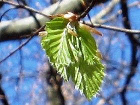
Spring
When the beech leaves burst our in May the forest gets an unreal, luminous green colour.
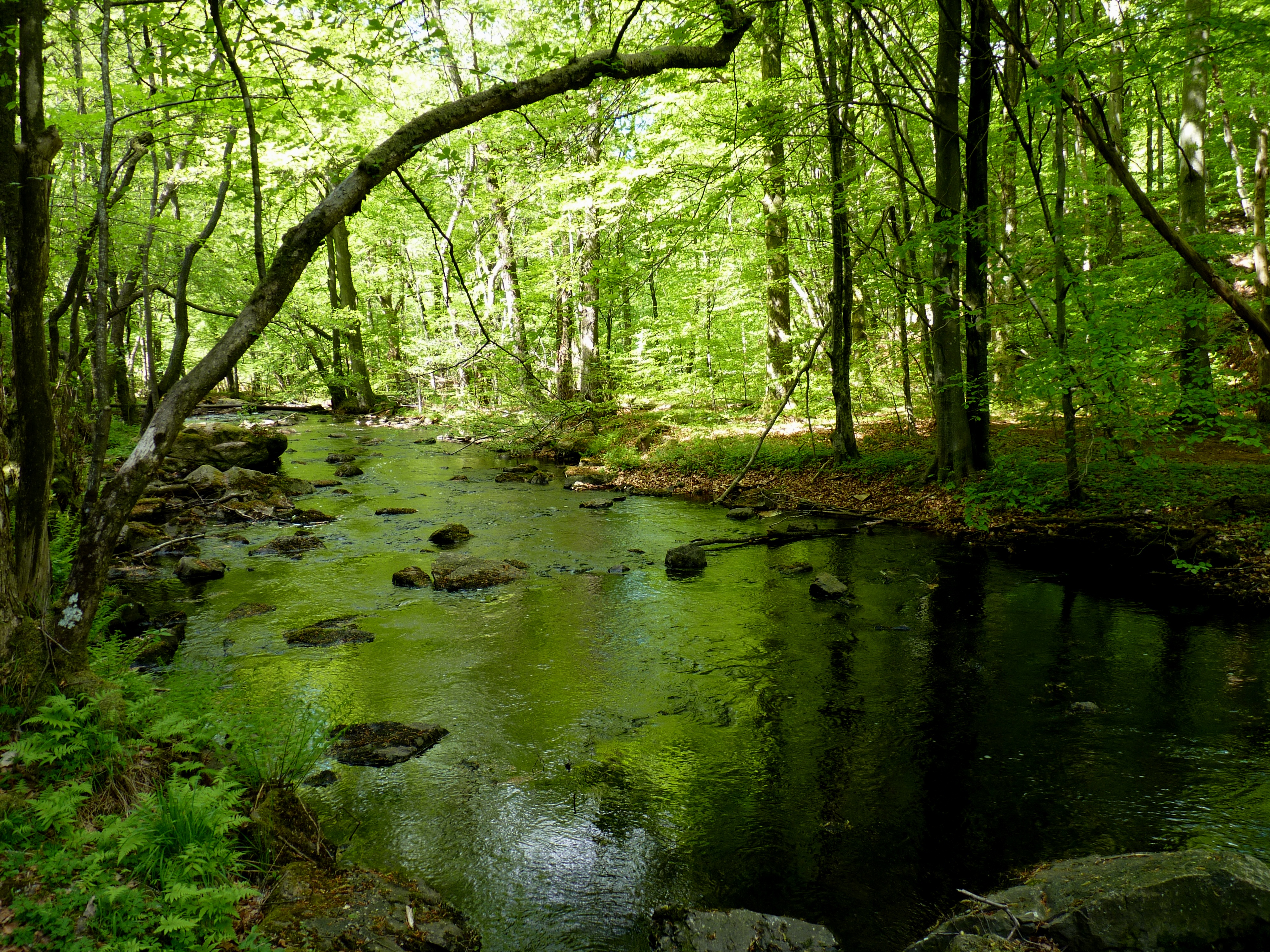
Summer
In the summer the colour green is deep and magical. A walk in the rift valley will be cool and comfortable.
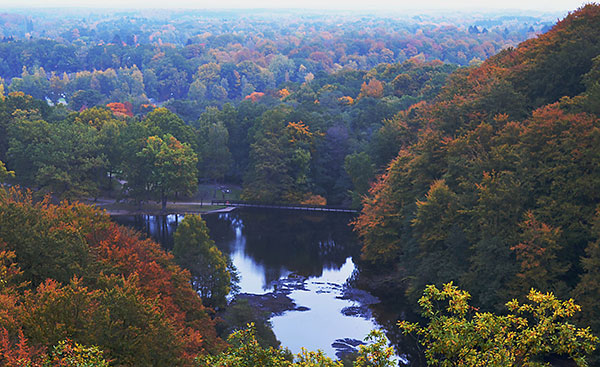
Autumn
In the autumn the forest will be covered with warm colours.
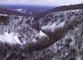
Winter
In the winter you will see the dramatic landscape with steep cliffs more clearly.
Clothes and equipment
If you walk the Skärdammen-pond walk, Kopparhatten-trail or Lake Odensjön-promenade you will be OK to wear regular shoes. For all other hiking routes we recommend hiking boots.
In spring, especially, there might be flooded paths in the rift valley and high water levels in streams. All depending on weather and snow depths.
If there has been rain - heavy rains or several days of rain - you should expect muddy patches on some of the hiking routes.
Weather
To be sure that you are properly dressed for your walk, it will be prudent to check the weather forecast for the area
General information about our hiking paths
We have about 50 km of hiking paths. Each route is well marked with a route specific colour. White markings are short-cuts or connecting paths.
Most routes are easy to walk; some are adapted for wheelchairs or prams. A few are considered difficult to hike. Regardless if you will walk for long or short, in terrain or on an even foot path it is important to prepare your visit.
A map with the hiking paths is available at our information boards in the national park or in the visitor centre - naturum Söderåsen and at the Tourist information in Röstånga. The map contains information of the hiking routes, their length and estimated duration to walk. In the visitor centre you will get up to date information or suggestions for alternative places to visit if you already tried everything!
If you want to prepare yourself at home you can download the map here.
Self-guiding leaflets
We have some leaflets with self-guide material over some of the paths. The brochures will guide you while you walk, or help you to prepare your visit. The leaflets are available in the visitor centre, but we can also send them to you, if you pay postage. See the page for hiking on this website (under experience) Contact information below.
Hiking routes and accessibility
The most popular hikes are the Kopparhatten trail (yellow) and the Hjortsprånget trail (blue). If you prefer to be more on your own, you can always make up your own route by combining existing routes or hike in the more remote areas such as Härsnäs trail or in Kvärk. If you are a skilled hiker you can always walk outside of marked trails.
Hiking routes suitable for wheelchairs or prams are for example Skärdammen runt trail (grey) or Lake Odensjöpromenade (black). Full white or gray lines on the map could also be used by more terrain going prams. Remember - you are in nature, stones, roots, slopes and uneven ground is all around.
Read more about accessability on the webpage with the title Accessability, or follow the link below.
The rift valley after the Skärdammen pond is not suitable for prams or wheelchairs. With the help of the map you are sure to find a trail suitable for you. You are welcome to talk to the visitor centre staff for directions or suggestions.
Toilets and water
Before you get going make sure to use the toilet and fill up your water bottle.
Toilets are available at the visitor centre in Skäralid (WC), in Nackarpsdalen valley (dry toilet), at Dahlbergs (dry toilet), at Kopparhatten (dry toilet) and at Liagården (dry toilet).
Wheelchair accessible toilets are available inside and outside the visitor centre in Skäralid and at Kopparhatten. Toilets with a changing table for babies is available inside and outside the visitor centre.
The toilets and changing tables inside the visitor centre are only available when the visitor centre is open.
Water is available outside the visitor centre in Skäralid. The water in the wells at Liagården and Dahlbergs is not tested for drinkingwater quality, and wells might run dry if there is no rain. Always bring your own water bottle.
Please note: At present there is no water available at the car park in Röstånga
If you have any questions or have encountered obstacles on your path - please contact the visitor centre for nature information and the national park management office for dangerous trees or other obstacles on our paths.
- naturum Söderåsen +46 10 224 11 50
- naturum Söderåsen e-mail
- Söderåsen national park management office e-mail
Share with your friends
Share this page with your friends on Facebook, X (formerly Twitter), Google+ and e-mail.